Kasiks

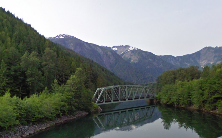
A train bridge passes over the Kasiks River just as it joins the Skeena River, as viewed from the Yellowhead Highway. The highway, which joins four Canadian provinces, runs next to the Skeena for a long and scenic stretch in British Columbia.

(Bonus tip: the Google Street View meeple is an eskimo!)

Un puente ferroviario pasa sobre el río Kasiks en su confluencia con el río Skeena, visto desde la Yellowhead Highway. La autopista, que une cuatro provincias canadienses, discurre junto al Skeena en este largo y pintoresco tramo a través de la Columbia Británica.

(Bonus tip: ¡el muñequito de Google Street View es un esquimal!)

https://goo.gl/maps/wU5Ac

Facebooktwittergoogle_plusredditpinterestFacebooktwittergoogle_plusredditpinterest

Malibamat’so

A bridge on the reservoir of the Malibamat’so River near the town of Ha Lejone in Lesotho. The reservoir, a widened version of the river path, is created by the second largest dam in Africa, which is also the one placed at a higher elevation.

Puente sobre el embalse del río Malibamat’so cerca de Ha Lejone, en Lesotho. El embalse, una versión ensanchada del recorrido del río, se debe a la segunda presa más grande de África, que es también la situada a mayor altura sobre el nivel del mar.

https://goo.gl/maps/7jGNX

Facebooktwittergoogle_plusredditpinterestFacebooktwittergoogle_plusredditpinterest