Saatse

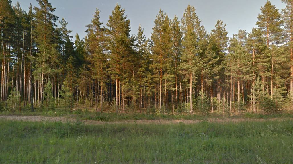
Perennious trees line the road across the Saatse Boot area of Russia, linking the Estonian villages of Lutepää and Sesniki. The 900 m stretch of Russian road is noteworthy in that, up until recently, it was the only way to reach a number of Estonian towns – making them into virtual exclaves, impossible to reach from the rest of Estonia without traveling through Russian territory.

Árboles de hoja perenne rodean la carretera que comunica las aldeas estonias de Lutepää y Sesniki atravesando el área rusa conocida como la Bota de Saatse. La particularidad del tramo ruso de carretera, de apenas 900 m, es que hasta hace bien poco era la única vía de comunicación hacia varias poblaciones estonias; éstas eran exclaves virtuales, imposibles de alcanzar desde el resto de Estonia sin pisar territorio ruso.

https://goo.gl/maps/tCPMP

Facebooktwittergoogle_plusredditpinterestFacebooktwittergoogle_plusredditpinterest

Uksichan

A view of the waters of the Uksichan river at Esso, a town in Kamchatka, as they merge with the Bystraya River. A popular destination for rafting, the Bystraya river traces a winding route through the volcanic landscape of the Russian peninsula and eventually meets the eponymous Kamchatka River.

Vista de las aguas del río Uksichan a su paso por la población de Esso, en Kamchatka, justo antes de confluir con el río Bystraya. Este río, popular entre los entusiastas del rafting, serpentea por el volcánico paisaje de la península rusa hasta acabar por encontrarse con el epónimo río Kamchatka.

https://goo.gl/maps/AaeMi

Facebooktwittergoogle_plusredditpinterestFacebooktwittergoogle_plusredditpinterest

Atol das Rocas

A rarity in the South Atlantic Ocean, the Atol das Rocas (Rocks Atoll) is a Brazilian nature reserve and World Heritage site. Remote and free of human presence, the atoll is home to numerous turtles, sharks, dolphins and birds who enjoy its character as a wildlife sanctuary.

Una rareza en el Atlántico Sur, el Atolón de las Rocas es una reserva natural brasileña reconocida como Patrimonio de la Humanidad. Remota y deshabitada, el atolón cobija a numerosas tortugas, tiburones, delfines y aves, que disfrutan de su carácter de santuario para la fauna.

https://goo.gl/maps/EYlER

Facebooktwittergoogle_plusredditpinterestFacebooktwittergoogle_plusredditpinterest

The caves of Khamar

In the heart of the Mongolian Gobi desert, and just a few miles to the north of the symbolic Khamar Monastery (which is also available in Street View), a crumbling collection of caves and walls greets the visitor. Those were used by monks in 108-day long meditation retreats.

En el corazón del desierto mongol del Gobi, apenas unos kilómetros al norte del simbólico monasterio de Khamar (también disponible en Google Street View), una ruinosa colección de cuevas y muros saluda al visitante. Aquí solían mudarse los monjes durante unos retiros de meditación que duraban 108 días.

https://goo.gl/maps/g79hw

Facebooktwittergoogle_plusredditpinterestFacebooktwittergoogle_plusredditpinterest